The Arlberg Giro route
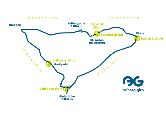
Start and Finish: Pedestrian zone St. Anton am Arlberg.
Route: St. Anton – Arlbergpass – Bludenz – Montafon – Silvretta – Paznauntal – St. Anton
Points of Refreshment
Point 1
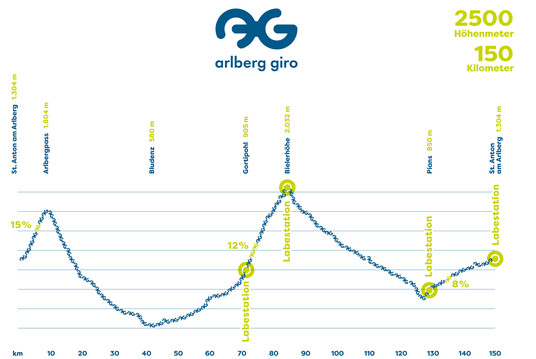
Gortipohl
905 m a.s.l
kilometre 60
Point 2
Bieler Höhe
2032 m a.s.l.
kilometre 82
Point 3
Pians
850 m a.s.l.
kilometre 124
Point 4
St. Anton - Finish Line
1304 m a.s.l
kilometre 150
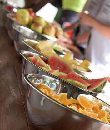
Available at all points of refreshment:
Water
Isotonic drinks, electrolytes, bars and gel from Hammer Nutrition
Cola
Rauch juices
Bananas
Apples
Bread rolls (with sausage and cheese)
Salzstangerl
and of course vegan alternatives
Available additional at the finish line:
Red Bull energy drink
Red Bull cola
Melons
Grapes
Salty snacks & Nuts pastries


